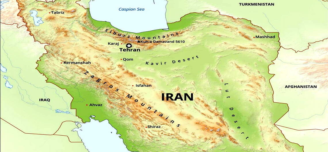
Iran Mountain Ranges
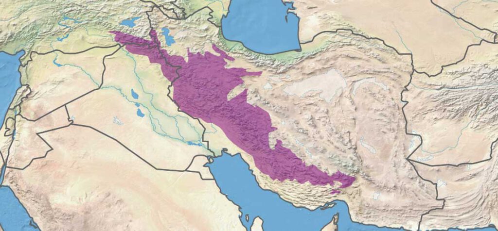
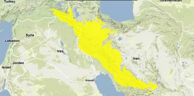
Iran with 1.64 million km2 has two major mountain ranges called Alborz and Zagros Mountain Ranges.
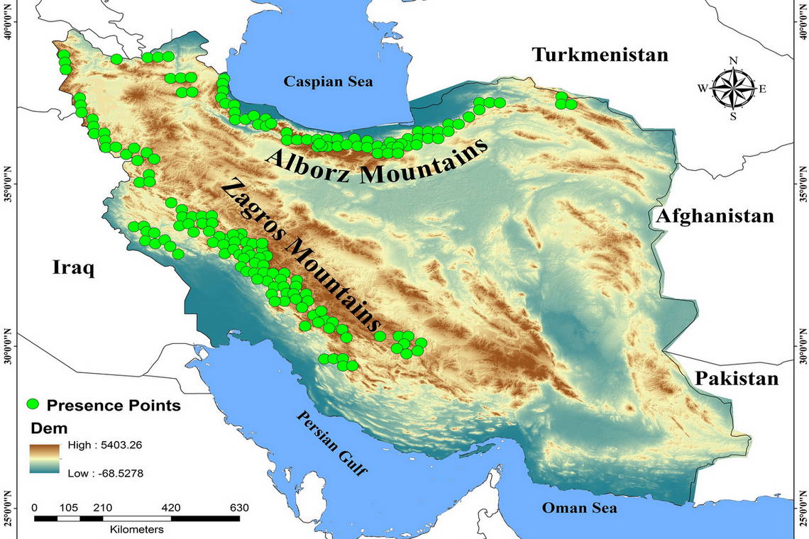
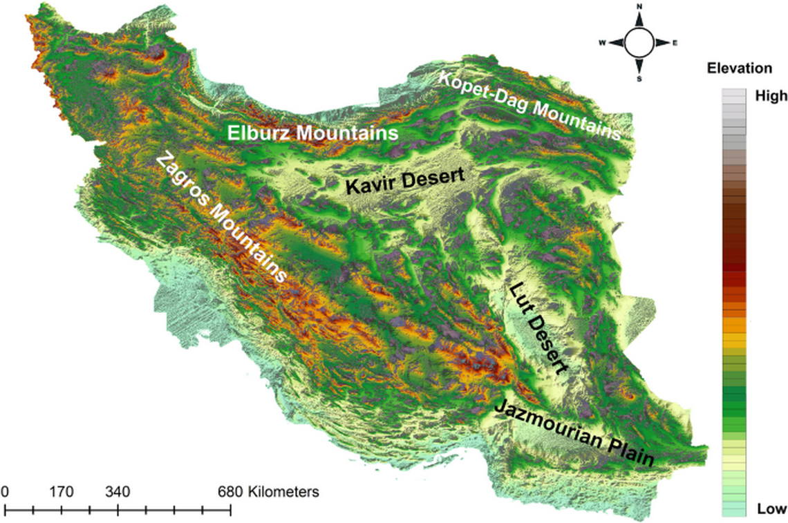
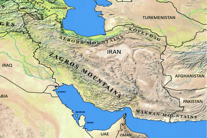
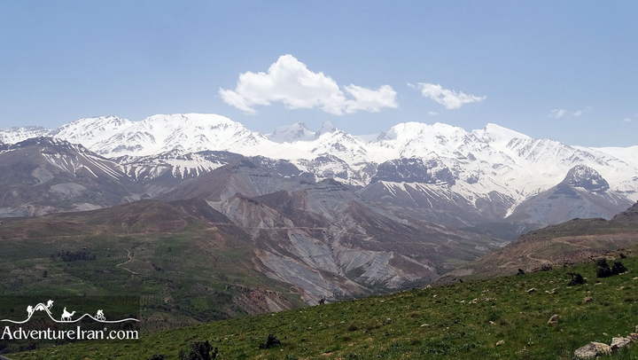
Alborz Mountain Range
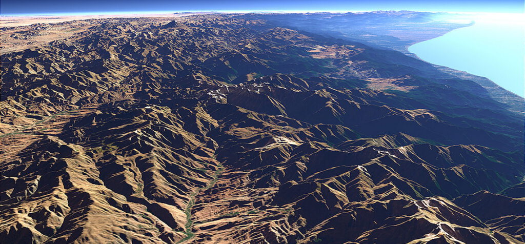
The first range is Alborz Mountains, also spelled Elburz, Albourz, Alburz, or Elburs. In the Persian language, it is called Reshte Koohe Alborz or Koohhayeh Alborz. This 900 km (560 miles) long mountain is the major mountain range in northern Iran. It stretches from Azerbaijan in the northwest of Iran (also southwest of the Caspian Sea) towards northeastern Iran in the Khorasan region (southeast of the Caspian Sea).
The Alborz Mountains range made a big wall between the Caspian Sea and Iran Plateau. It created two different climate systems on the northern slopes of Alborz against the southern side of the huge mountain range.
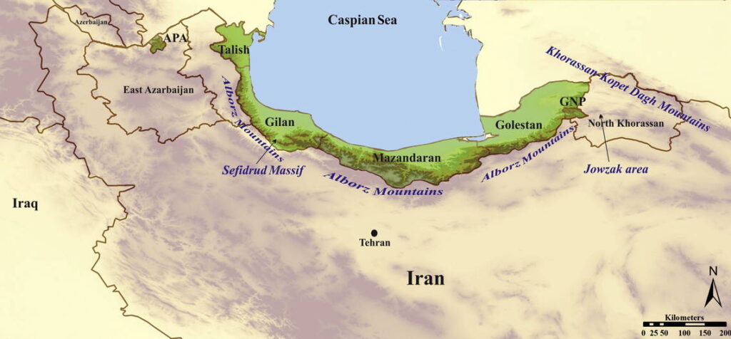
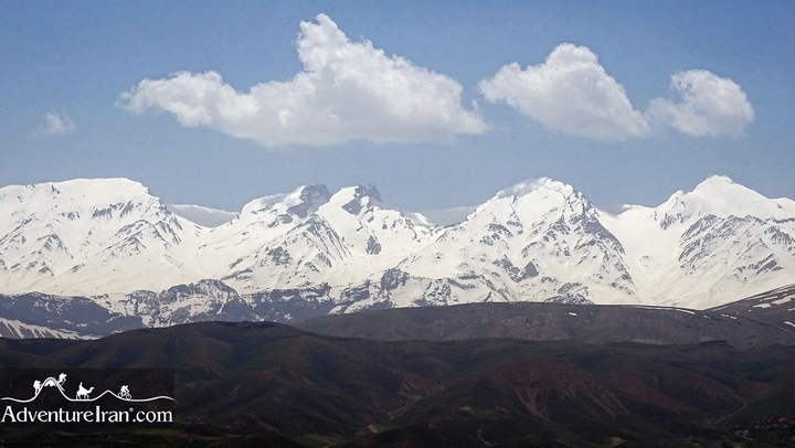
There are a few famous mountain chains and a lot of high peaks in different parts of the Alborz ranges. Talesh mountain chains, Takht-e Soleyman mountain chains, and Shahkuh mountain chains are subranges of the Alborz range located in the western, central, and eastern parts of the range. Moreover, two of Iran’s highest mountains, Mt Damavand 5610m and MT Alamkuh 4850m, are located in the Alborz range.
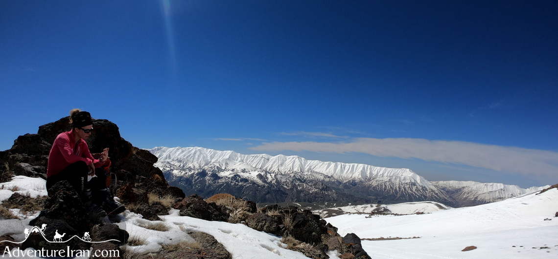
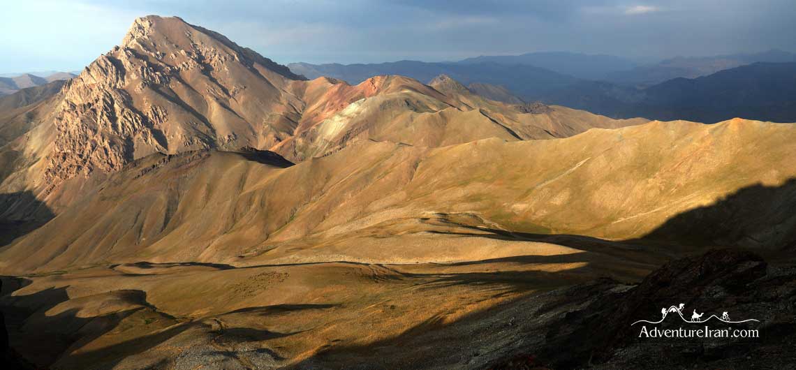
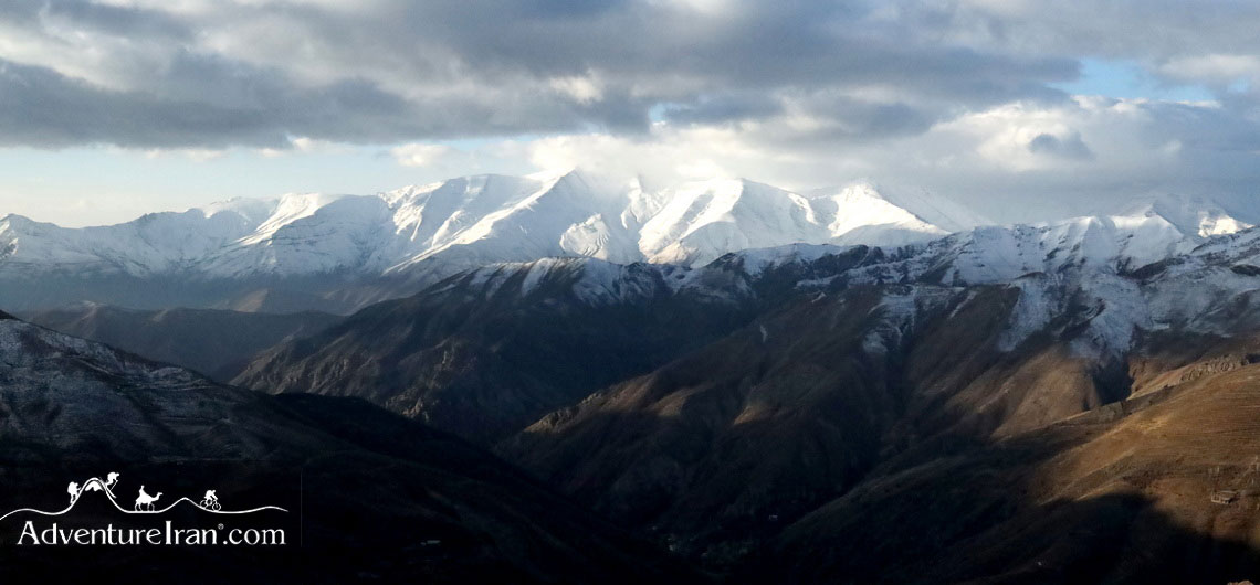
The Alburz mountain system traverses virtually all of the northernmost portions of Iran from east to west. In addition, there are plenty of high-altitude famous mountains above 4000m extended in the Central Alborz Mountains which is in the north of Tehran province. Mt Kholeno (4375m), MT Azadkuh (4355m), MT Kolonbastak (4150m), MT Sarakchal (4210m), and MT Tochal (3963m) are the most famous high peaks located in central Alborz Mountains.
The weather on the northern side of Alborz, called the Caspian slopes, has a distinctly humid climate. The famous Hyrcanian forests, which are Iran’s natural UNESCO heritage site, are located in that region too. On the southern side of Alborz, the climate is not humid. When you go lower to the south, the weather is getting drier and the temperature higher accordingly.
Alborz range has several national parks and protected areas as well. They are well-known for wildlife, birds, flora and fauna. The most famous ones are Lar National Park, Alborz Markazi protected area, Touran National Park, and Golestan National Park.
Zagros Mountain Range
The second Iran major mountain range is the Zagros Mountains. This range is longer. It starts from northwest of Iran in the border areas of eastern Turkey and northern Iraq, stretches to the southwest of Iran, and continues all the way to the Strait of Hormuz in the Persian Gulf. The mountain range of Zagros is about 1600km long (990 miles) and about 240km wide (150 miles).

Furthermore, there are a few famous sub-ranges in Zagros. The Dena Mountain chain and MT Zardkuh chain (Zardkooh) are the most famous sub-ranges of Zagros. MT Bijan 3 (Ghashmastan peak 4400m) is the highest mountain of Zagros, located in the Dena Mountain chain. There are numerous protected areas and national parks in Zagros as well. Dena National Park is one of the most famous parks which is a UNESCO biosphere reserve park.
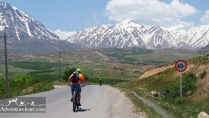
In both the Alborz and Zagros ranges, there is a list of famous mountains which is perfect for adventure activities such as trekking, mountain biking, and ski touring. Please check Iran’s most famous mountains and high peaks post to get more information about Iran’s mountains which are perfect for an ascent. Gathering a good deal of information about each one of them before making a plan to travel is crucial. Knowing the best travel time for each one is the main key before planning.
The best travel time for a few of them is the spring season, while summer is the best travel time for some of the high peaks above 4000 m. Besides, there is a mountain (Taftan Volcano) on the list which is perfect to ascend during the winter season. To get more information about the best travel time for hiking in Iran, please check out this post: Best time for trekking in Iran.
In addition, if you are looking for Iran’s Off the Beaten Track regions, you could read 10 Best Off the Beaten Path Hiking Trails in Iran, including a list of proper trails in different parts of the country.
Comments