Geography
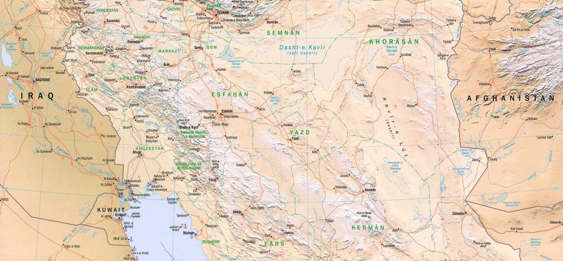
Iran is the 18th largest country in the world, at 1,648,195 km² its area roughly equals that of the United Kingdom, France, Spain, and Germany combined, or slightly less than the state of Alaska. It is a country of special geostrategic significance due to its central location in Eurasia.
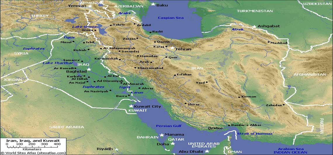
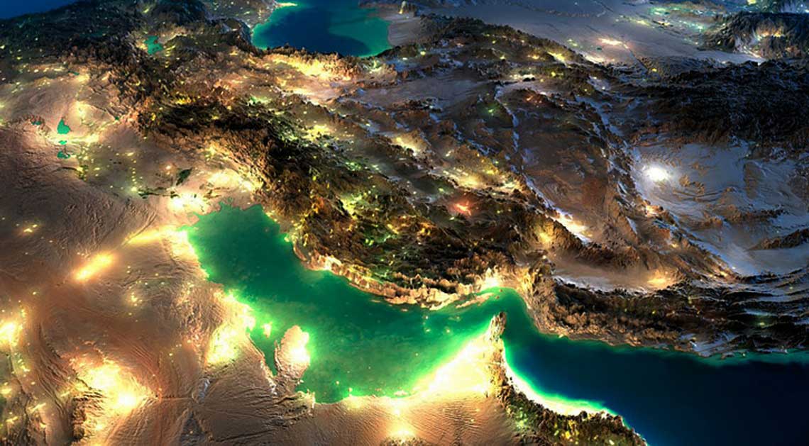
The country is bordered on the north by Armenia, Azerbaijan and Turkmenistan. These borders extend for more than 2,000 kilometers, including nearly 650 kilometers of water along the southern shore of the Caspian Sea. Iran’s western borders are with Turkey in the north and Iraq in the south, terminating at the Shatt al Arab (which Iranians call Arvand Rood). The Persian Gulf and Gulf of Oman littorals form the entire 1,770-kilometer southern border. To the east lie Afghanistan on the north and Pakistan on the south. Iran’s diagonal distance from Azerbaijan in the northwest to Baluchestan and Sistan in the southeast is approximately 2,333 kilometers.
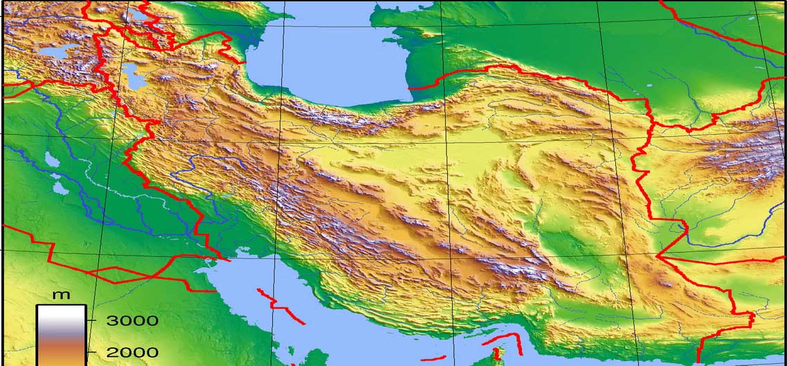
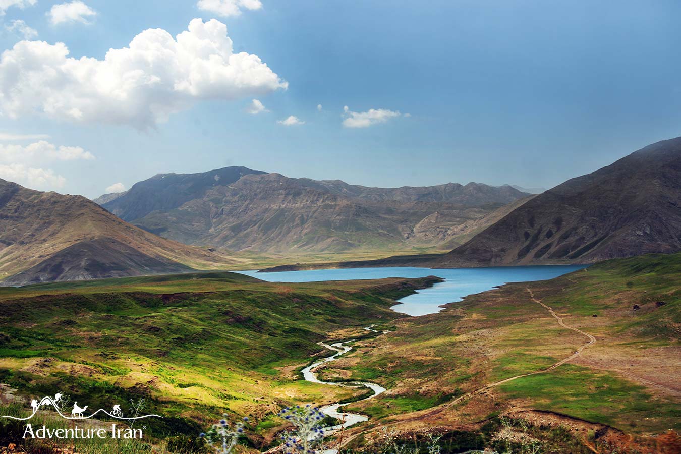
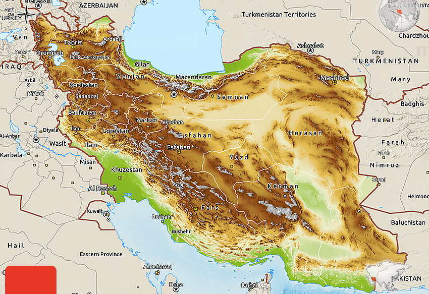
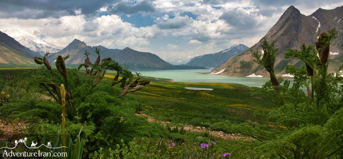
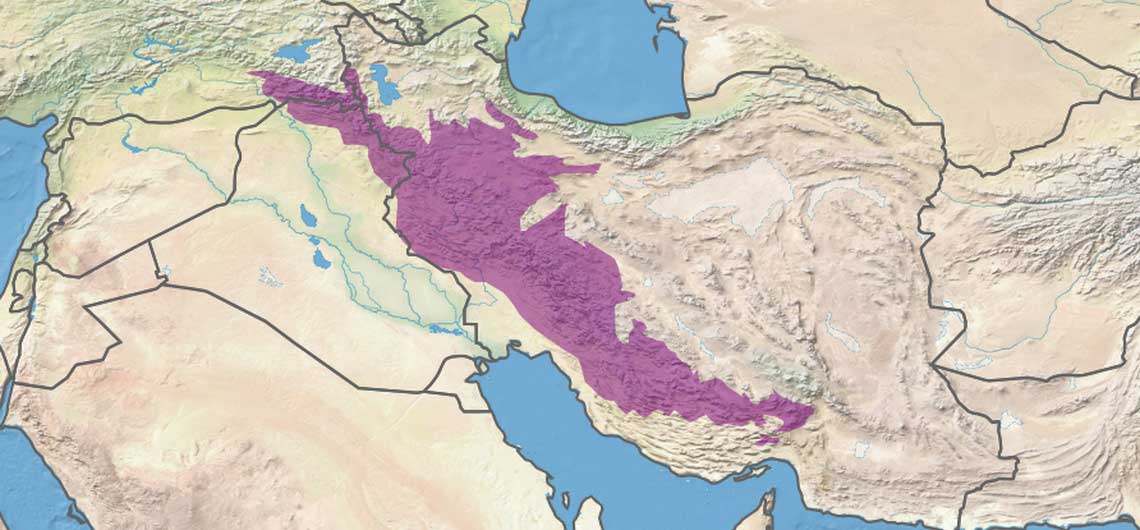
The Zagros Mountains form the main mountain range, a series of parallel ridges interspersed with plains that bisect the country from northwest to southeast. Many peaks in the Zagros exceed 3,000 meters above sea level, and in the south-central region of the country there are at least five peaks that are over 4,000 meters. As the Zagros stretch into southeastern Iran, the average elevation of the peaks decline dramatically; culminating to elevations of about 1,500 meters. Rimming the Caspian Sea littoral is another chain of mountains, the narrow but high Alborz Mountains. Volcanic Mount Damavand (5,671 meters), located in the center of the Alborz, is not only the country’s highest peak but also the highest mountain on the Eurasian landmass west of the Hindu Kush.
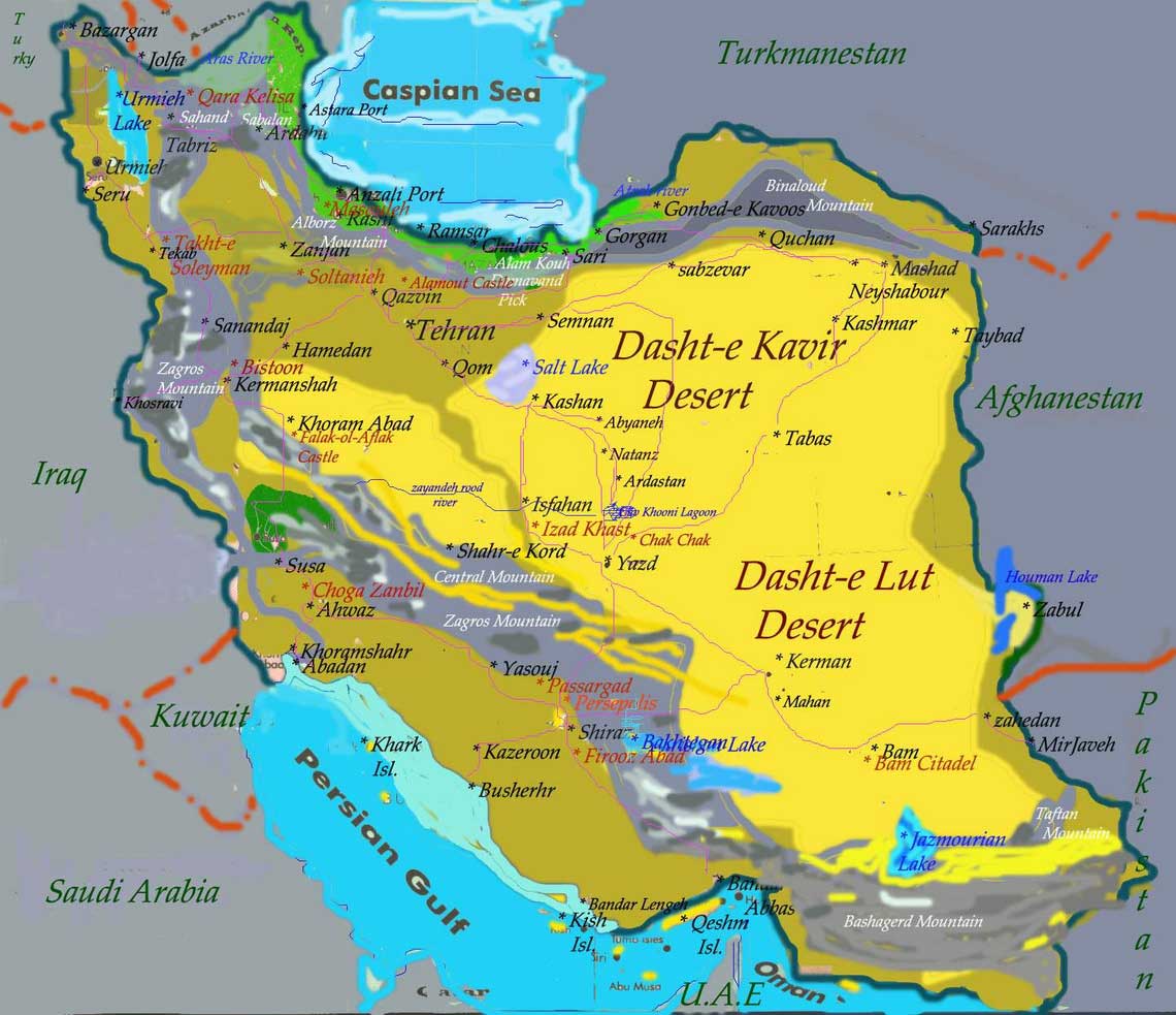
The central region consists of several closed basins that collectively are referred to as the Central Plateau. The average elevation of this plateau is about 900 meters, but several of the mountains that tower over the plateau exceed 3,000 meters. The eastern part of the plateau is covered by two salt deserts, the Dasht-e Kavir (Great Salt Desert) and the Dasht-e Lut. Except for some scattered oases, these deserts are uninhabited.
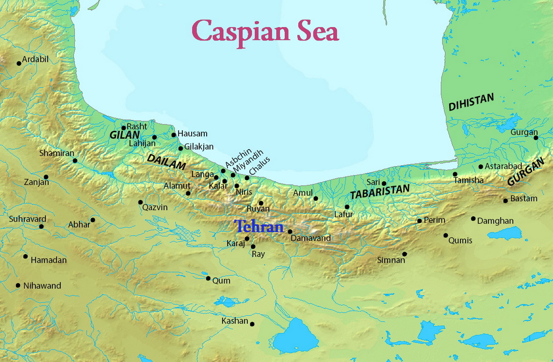
Iran has only two expanses of lowlands: the Khuzestan Plain in the southwest and the Caspian Sea coastal plain in the north. The former is a roughly triangular-shaped extension of the Mesopotamia plain and averages about 160 kilometers in width. It extends for about 120 kilometers inland, barely rising a few meters above sea level, then meets abruptly with the first foothills of the Zagros. Much of the Khuzestan plain is covered with marshes. The Caspian plain is both longer and narrower. It extends for some 640 kilometers along the Caspian shore, but its widest point is less than 50 kilometers, while at some places less than 2 kilometers separate the shore from the Alborz foothills. The Persian Gulf coast south of Khuzestan and the Gulf of Oman coast have no real plains because the Zagros in these areas come right down to the shore.
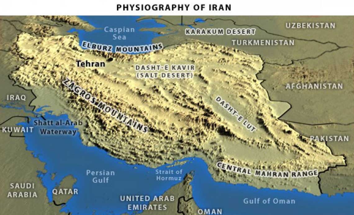
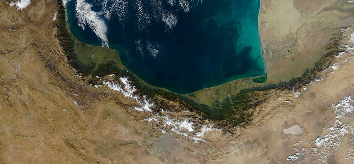
There are no major rivers in the country. Of the small rivers and streams, the only one that is navigable is the Karun, which shallow-draft boats can negotiate from Khorramshahr to Ahvaz, a distance of about 180 kilometers. Several other permanent rivers and streams also drain into the Persian Gulf, while a number of small rivers that originate in the northwestern Zagros or Alborz drain into the Caspian Sea. On the Central Plateau, numerous rivers, most of which have dry beds for the greater part of the year, form from snow melting in the mountains during the spring and flow through permanent channels, draining eventually into salt lakes that also tend to dry up during the summer months. There is a permanent salt lake situated in the northwest called Lake Urumiyeh, whose brine content is too high to support fish or most other forms of aquatic life. There are also several connected salt lakes along the Iran-Afghanistan border in the province of Baluchestan and Sistan.
The two mountain ranges mentioned above provide for a variety of climates. Most of the country however is arid or semi-arid with limited rainfall.
Agriculture and Natural Resources
The Caspian Sea
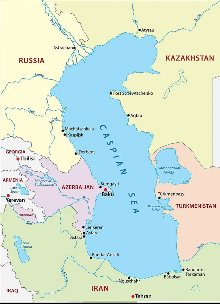
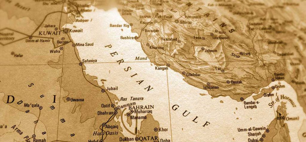
Unlike Iran’s southern waterway (Pars Sea), about which there has never been any ambiguity and which has been referred to by various names synonymous to that of the Persian Gulf throughout the course of the written history, in particular since 600 BC, the waterway in northern Iran currently known as the Caspian or Mazandaran Sea is called by different names. The Arabic states call it Bahr-e Qazvin (Qazvin Sea) or Caspian, while the Turks, Europeans and other nations refer to it as the Caspian Sea. Meanwhile, a variety of other names by which the waterway has been called since 500 years ago have been recorded.
The tourist attractions and presence of various tribes in the surrounding areas are among the reasons accounting for it. Even today 50 tribes with various dialects reside in the area. The names of the sea have been derived from five roots, which also designate the tribes residing in the vicinity, the surrounding towns and port cities as well as a few equivalents of the word`Sea’ in other dialects and others which have been used to refer to the waterway without any justification.
The toponymy of the waterway in northern Iran comprises the names of continents, oceans, seas, lakes, countries, forests, mountains and deserts which are part of the history, geography, mythology, culture and customs of various nations and tribes. In other words, they are the national identity of various tribes, which should be safeguarded as material and spiritual treasures, similar to ancient objects and documents. Such geographical names also designate the sovereignty, precinct of the government as well as the administrative, political and ideological system of the countries. That’s why respect for the history and geographical facts have priority to tribal and racial sentiments. Meanwhile, historical names should not be abused as political tools to achieve tribal and racial objectives, humiliate other ethnic tribes or contradict the national interests and values of others. Obviously, changing the name of any geographical venue which has been representing a particular area throughout the centuries is a threat to its national security and historical identity. Among all such historical names, the Persian Gulf and Caspian Sea are chosen to be examined from various aspects.The name of Persian Gulf has been recorded in more than 300 historical, literary and geographical sources as well as 2,000 ancient maps dating back to the 19th century. Those who changed the historical names mainly aimed to raise doubt about Iran’s sovereignty upon some of the Persian Gulf islands.
Deserts
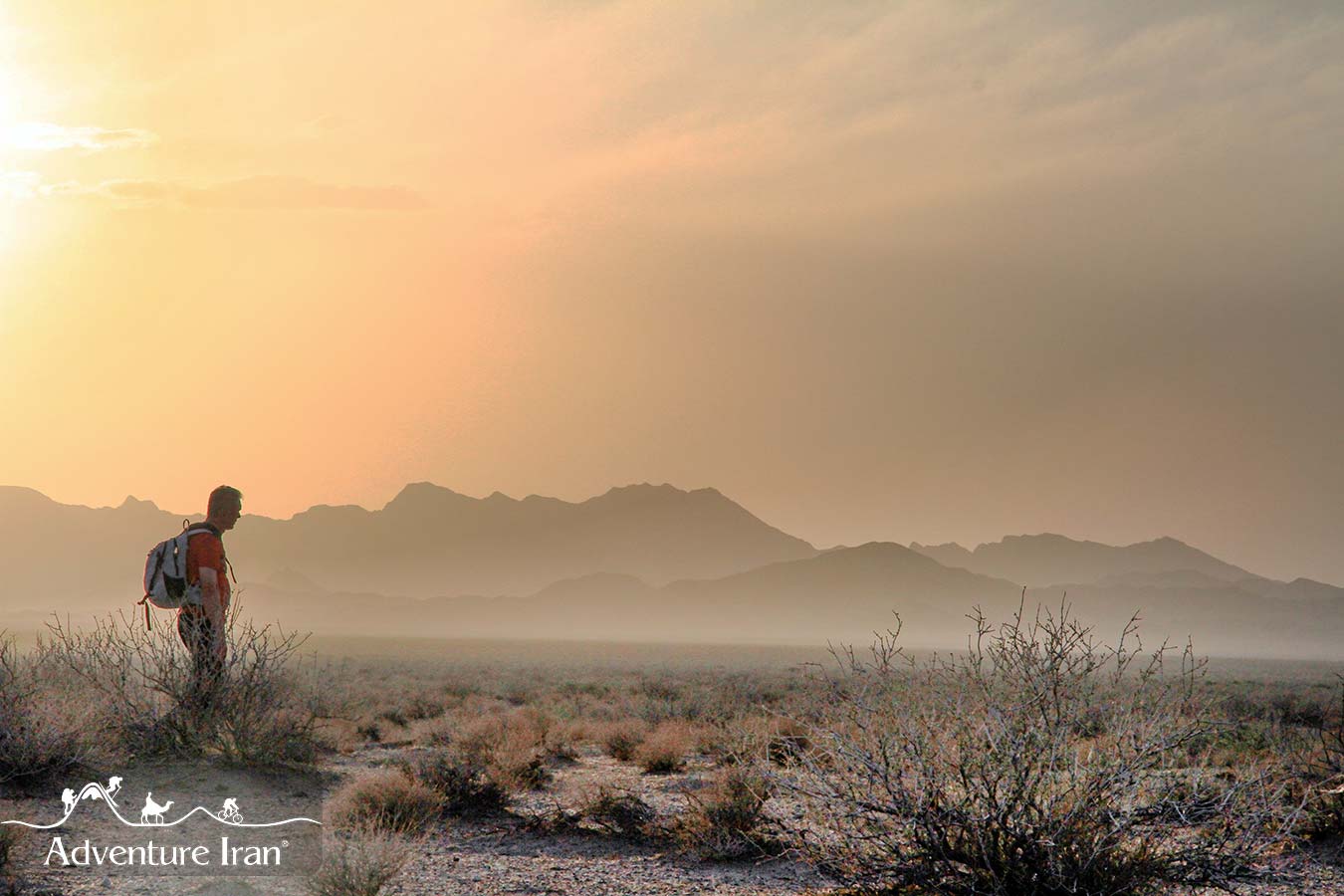
Two main deserts, “Dasht-e Kavir” (Kavir-e Namak) and the “Lut” cover the main part of the central plateau. The Lut Desert is known as one of the driest and most undiscovered places in the world, and is full of geological wonders. The midpoint of the “Lut” has an altitude of about 300 meters from the sea level and is one of the hottest places in the world. Dasht-e Kavir Desert also has its own attractions. There are watery salt plates, the water of which evaporate quickly and leave the wide flat mosaic-like plates of salt. The most beautiful of them can be seen in the great salt lake in the western part of Dasht-e Kavir.
The wildlife combination at the central plateau varies according to different habitats from mountainous to desert. The endemic Pleske’s Ground jay
(Podoces pleskei), lives in some parts of this plateau. Other desert birds like Houbara bustard, various Larks and Sand grouses … are common.
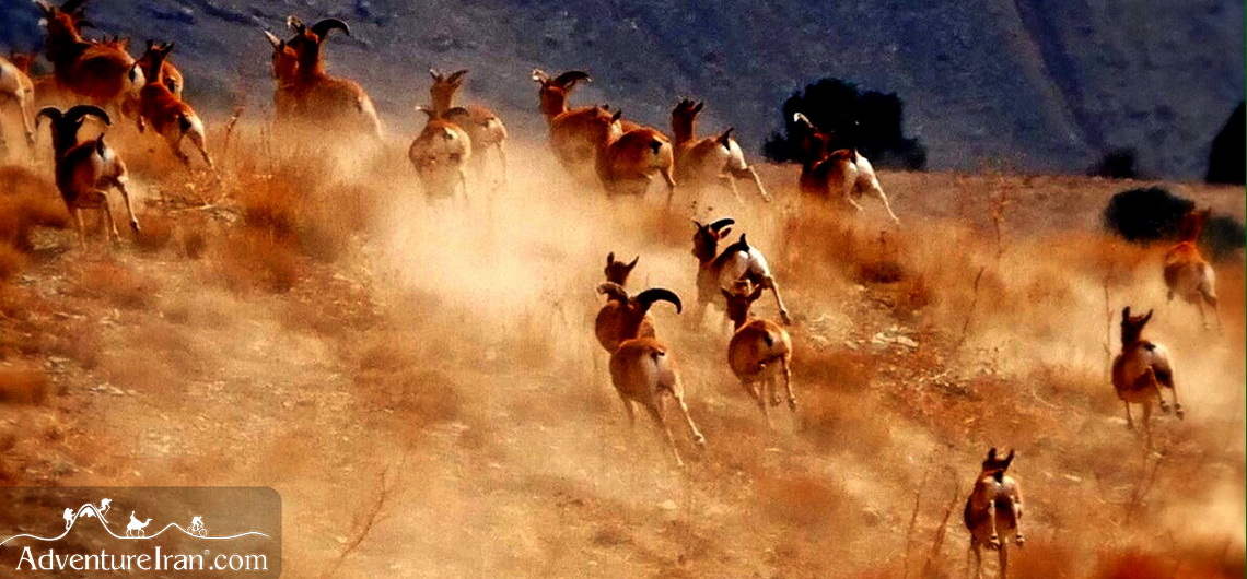
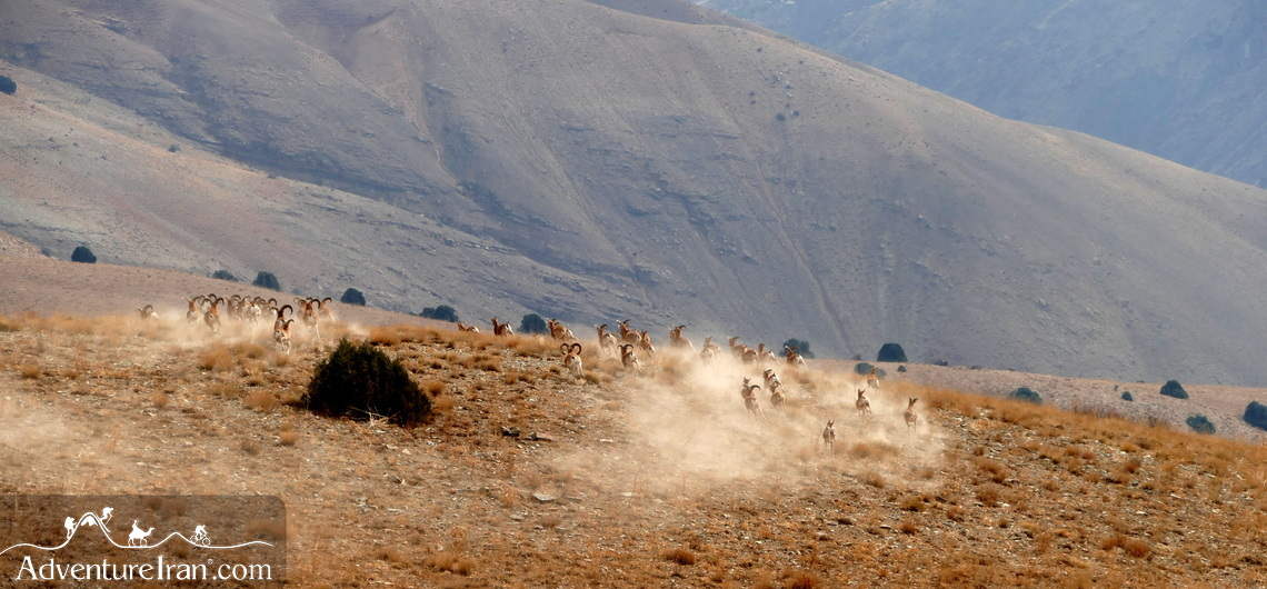
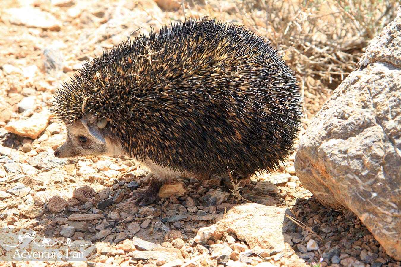
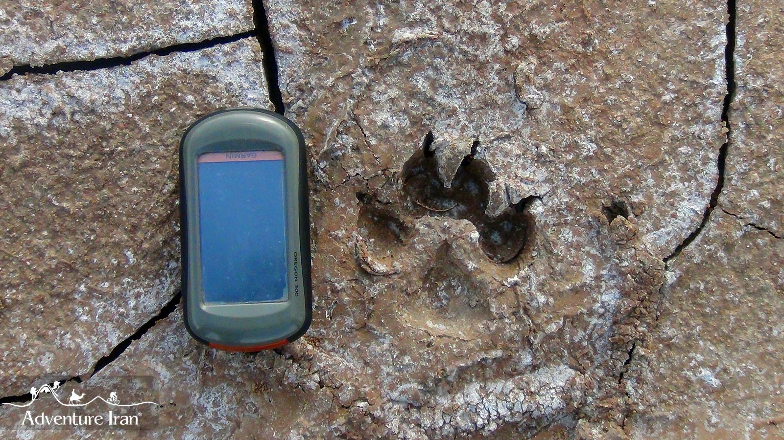
Beautiful Persian Gazelles, Goitred gazelle and Jebeer, live in parts of steppe and desert habitats of the central plateau. The last reminiscence of the Asian Cheetah can still be seen in some places in the deserts. In some parts of the Dasht-e Kavir, considerable populations of The Persian Wild Ass scroll around. In the night, these areas are arena to various Wild Cats, Wolf, Fox and other carnivores. Different places in the central plateau are home to Lizards and Snakes.
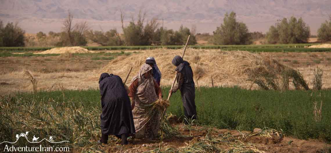
Hard-working and enduring people live around the deserts, accepting the harsh conditions of the area. Camel and Sheep breeding and agriculture are the only sources of living to them. The main population-limiting factor in the area is lack of water. For a best use of water, these people have created a complicated well-system known as “Ghanat”. Dating back to thousands of years ago and still working, these “Ghanats” are comparable to the most modern Technologies of water-revenue. Researches say the total length of the Ghanats in Iran is as long as the distance between the Earth and the Moon!
To visit sand dunes, beautiful sunrise and sunset in the desert, walk on polygons, camel riding, camping under the blazing sky and getting familiar with the life style, culture and architecture of these regions are among the many activities to make a wonderful and memorable experience.

Flora & Fauna
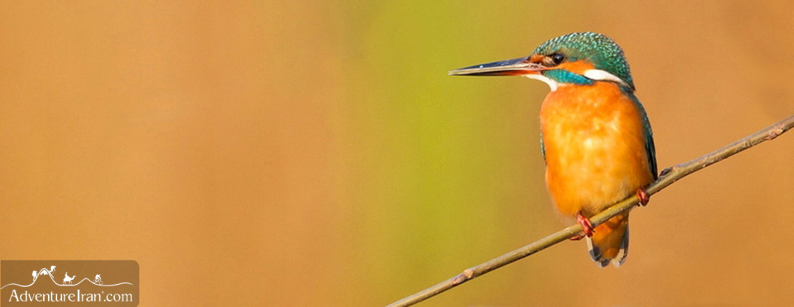
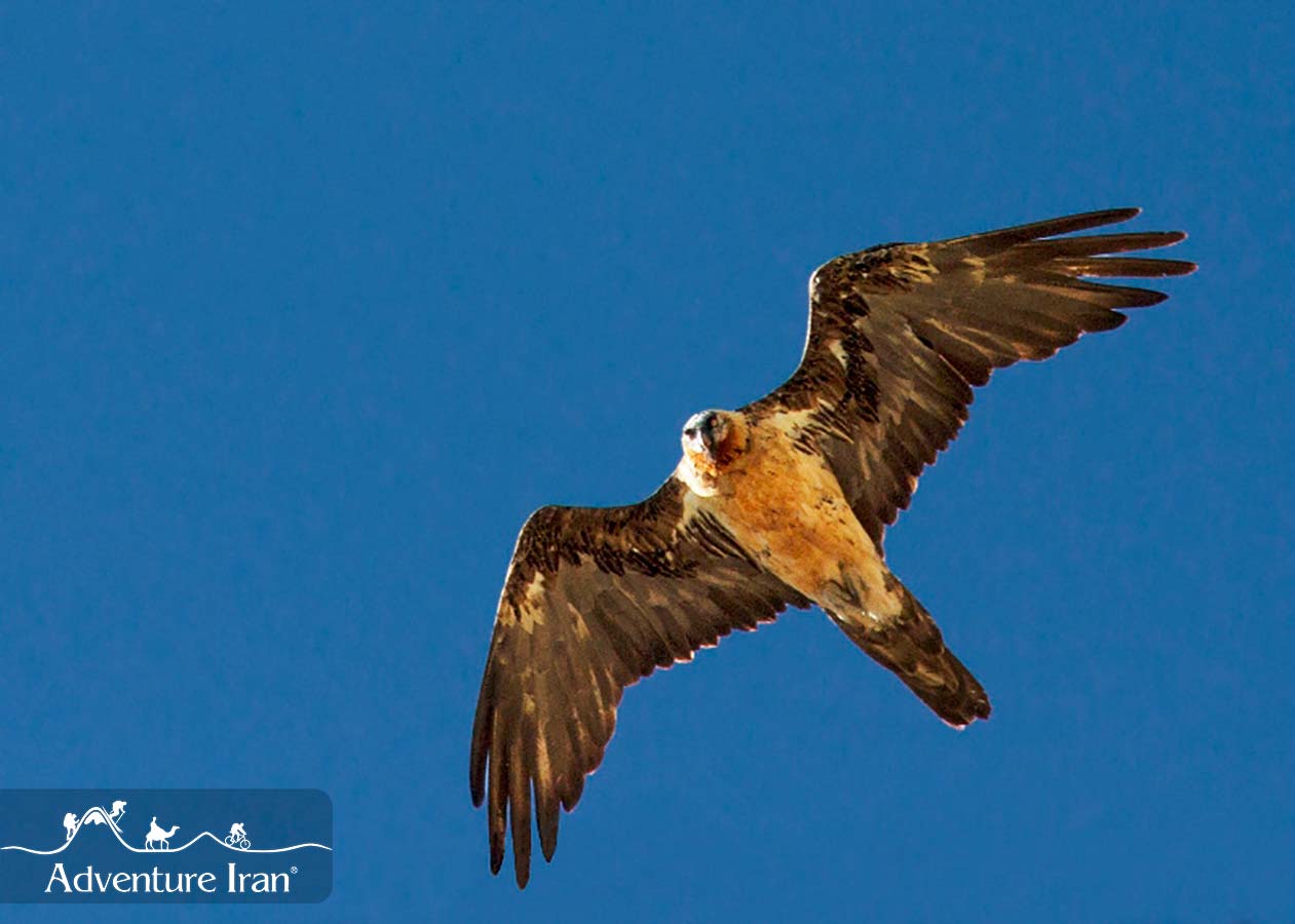
Iran possesses an extremely diverse fauna and flora, partly because of its great range of habitats - from permanent snows to deep deserts and from lush deciduous forests in the north to palm groves and mangroves in the south – and partly because of its position at a crossroads between three major faunal regions. The greater part of the country is situated in the Palearctic Region, with typically Western Palearctic species predominating throughout the northwest, west and central parts of the country and some typically Eastern Palearctic species extending into northeastern Iran in the highlands of Khorasan. In southern Iran, two other faunal regions have a pronounced influence: the Indo-malayan Region in the southeast, and the Afro-tropical Region in the extreme southwest. About 125 species of mammals (Harrington, 1977; Eetemad, 1986) and 500 species of birds (Scott et al., 1975; Mansoori, 1995) have been recorded, while at least 270 species of fish (including 33 endemic species) are known from the Persian Gulf and Caspian Sea. A recent check-list records over 1,000 species of fish as being known to occur or potentially occurring in Iranian fresh and salt waters.

Botanically, Iran forms a bridge between four major phyto-geological regions: the Irano-Turanian, Saharo-Arabian, Euro-Siberian and Sudanian (Zohary, 1973). It is also one of the largest speciation centers of the Holarctic desert flora, with Irano-Turanian species predominating. The total number of plant species present has been variously estimated at between seven thousand and ten thousand, about 20% of which are endemic.
According to FAO reports [1], the major types of forests that exist in Iran and their respective areas are:
• Caspian forests of the northern districts (3.3 million ha)
• Limestone mountainous forests in the northeastern districts (Juniperus forests, 1.3 million ha)
• Pistachio forests in the eastern, southern and southeastern districts (2.6 million ha)
• Oak forests in the central and western districts (10 million ha)
• Shrubs of the Kavir (desert) districts in the central and northeastern part of the country (1 million ha)
• Sub-tropical forests of the southern coast (500,000 ha)
The Mountains
The mountains of Iran which are the most beautiful and distinct features of the country, cover more than half of land area. There are two main ranges of “Alborz” with an east-west direction and “Zagros” with a northwest-southeast extension, which cover most of the high mountains in Iran. Many “single” high mountains are also spread in other areas and especially around the central plateau of Iran.
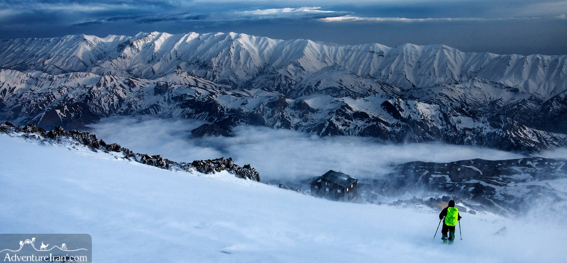
The beautiful Alborz mountain range in the north contains a collection of the highest mounts in Iran. “Damavand”, with a 5671-meter altitude, is a volcanic cone. “Alam-kooh”, 4850m with forested slopes, has 850 meters of fine rock wall, excellent for rock-climbing. There are also many other peaks over 4000 meters high.
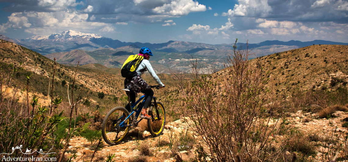
In the Zagros range, most of the mountains are calcareous with deep valleys and meandering rocks.
Famous mountains such as “Dena” with several high peaks, the beautiful peak of “San Bran”, with Gahar Lake, “Zardkuh” and many other peaks over 4000m, stand straight under the blue sky. But there are other peaks of over 4000m in other areas as well. Examples are “Taftan” volcanic cone in Baluchestan with volcanic gases still erupting out, and the splendid “Sabalan” peak in Azerbaijan with slopes covered with wild flowers and a beautiful lake in the volcanic pit at its peak frozen nearly all year round.
Persian Gulf Region
In the area between the Persian Gulf and south skirts of Zagross and Macran mounts, there are plains with very specific characteristics. In these regions, in spite of high humidity, the rainfall is very limited.
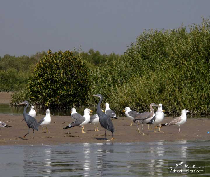
The natural sceneries are very much similar to South African Savannas, and the plants are very sensitive to climate changes and cold weather. The birds specious are like the ones in India and Africa. Some islands in the Persian Gulf like Kish and Qeshm are urban, and some others such as Shidvar and Nakhiloo are non residential. The bird fauna of this region is also influenced by Indian and African elements. Sunbirds, Rollers, Mynah, little green Heron, Grey Hypocolius and the little green bee-eater are a few examples. By the end of spring many sea birds lay their eggs in these regions and create wonderful scenery.
The mammals are similar those of the central plateau; Goitred gazelle and Jebeer gazelles are seen in the flat areas, while there are leopards and wild sheep and wild goat on the hills. One can also see Hyena, Fox, Jackal, Black bear and Mongoose in these plains. People, just like the mammals and plants, are of different races: in the western parts, there are Arabs, while Balooch and Pakistanis are in the East.
These coasts and islands are the best ovipositor places for three species of sea turtles, among which the Hawksbill turtle is the most common. The Marsh Crocodile is one of the important reptiles of the region, which is found in only one river known as “Bahukalat” in the easternmost portion of the southern plains.
The cliffs and coral beaches create wonderful scenery and the coral reefs are the best site for snorkeling and diving. Wind erosions, Mangrove Forest, Namakdan Cave and Valley of Stars in Qeshm and Mud Volcano and geological erosions in Sistan and Baluchistan are considered among wonders of southern regions of Iran.
Wildlife
There are about 10000 species of plants, 517 species of wild birds (almost equal to the number of birds and plants living in Europe), and 194 species of mammals, which undoubtedly should draw the attention of every specialist and animal lover. These species including some precious and rare species like Siberian Crane, Plesk’s Ground jay, Houbara Bustard, Falcons, Imperial Eagle, Dalmatian Pelican. Mammals have the same importance and attraction and are good examples of Iran’s great biodiversity. One can see the Persian Fallow deer which was thought to be extinct, Asian Cheetah which is already in danger of extinction, Persian Wild Ass, Asiatic Black Bear, and three species of genus Gazella. In the mountains, Wild sheep, Wild goats and Leopards still exist. Of course all these animals need more protection to survive. It is also worth noting that the Persian Gulf is the habitat of the biggest mammal of the world, Blue Whale while in the terrestrial habitats of Iran the smallest mammal named Pygmy White-toothed Shrew is well living.
Among the numerous marine animals of the Caspian Sea are Sturgeons which are famous for their Caviar eggs. The sturgeon have an ancient heritage and are a very old species. Caviars are also called “the black pearl” all over the world.
In certain locations, the gathering and presence of plant and animal species in a small and isolated area or nearby areas and their inter-related habitats have created precious and unique ecosystems. Nature’s resultant handiwork becomes starkly beautiful in an esthetic sense and important ecosystem in its own right. Some of these areas have been designated Biosphere Reserves and Wildlife Refuges usually according to international standards, but real protection is uneven and spotty.