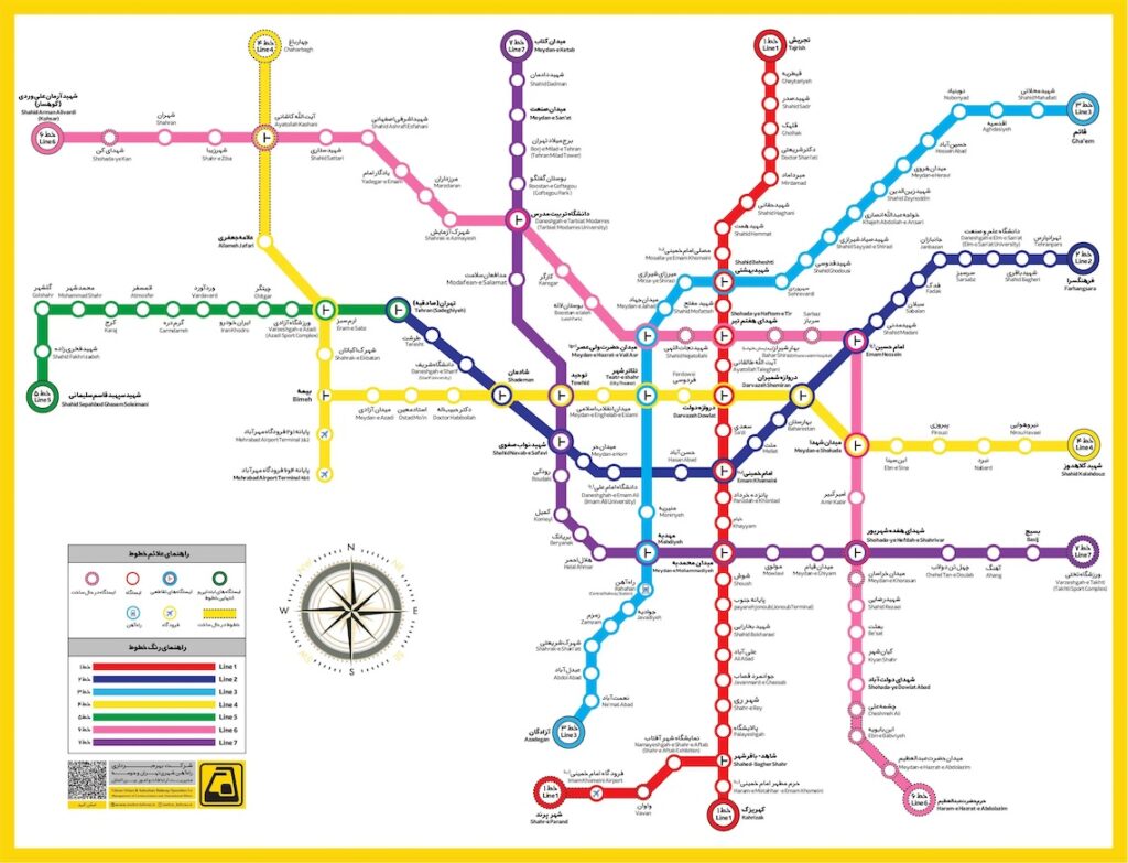
Tehran Metro Guide Map
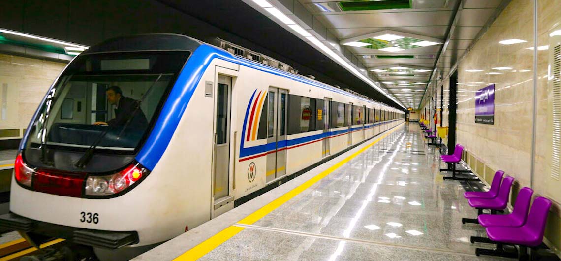
The Tehran Metro is a fastest transportation system in Tehran, the capital of Iran. It is the largest metro system in the Middle East. It consists of six operational metro lines (and an additional commuter rail line), with construction under way on four lines including northwestern extension of line 4, south extension line 6, north and east extension line 7 and Line 10.
Discover Tehran Metro: The Beating Heart of Iran’s Capital
As one of the most modern and efficient metro systems in the Middle East, the Tehran Metro is not just a transportation network—it’s a gateway to the city’s history, culture, and daily life. With over 7 lines and 120 stations, it connects Tehran’s bustling neighborhoods, historic landmarks, and commercial hubs, offering both convenience and a glimpse into Iranian urban life.
Why Ride the Tehran Metro?
✔ Affordable & Efficient: Avoid traffic while zipping across the city at a fraction of the cost of taxis.
✔ Clean & Safe: Women-only cars (during peak hours) and strict security ensure comfort for all passengers.
✔ Cultural Stops: Key stations like Tajrish (for the bazaar), Meydan-e Azadi (Azadi Tower), and Meydan-e Imam Hossein (for parks and theaters) put Tehran’s highlights within easy reach.
✔ Art Underground: Many stations feature stunning tilework, murals, and calligraphy celebrating Persian heritage.
Pro Tips for Travelers
- Get a Metro Card: Rechargeable cards (sold at stations) make rides seamless.
- Avoid Rush Hour: 7–9 AM and 4–6 PM get crowded.
- Combine with Attractions: Use Line 1 (Red) for Golestan Palace or Line 4 (Yellow) for the Milad Tower.
The Tehran Metro carries more than 3 million passengers a day. In 2018, 820 million trips were made on Tehran Metro. As of 2020, the total system was 253.7 kilometers (157.6 mi) long, 186 kilometers (116 mi) of which is metro-grade rail. It is planned to have a length of 430 kilometers (270 mi) with eleven lines once all construction is complete by 2040.
On all days of the week, the Metro service runs from 04:30 to 22:00.
The line uses standard gauge and is mostly underground. Ticket price is 3,500 Iranian Toman for each journey (about US$0.05), regardless of the distance traveled, but using prepaid tickets costs much less. On all Tehran metro trains the first and half of the second carriages from each end are reserved for women. Women can still ride other cars.
For good quality PDF file of the map please click Tehran Metro Map.
Comments